
Quick answer: Land for sale in Pinon Hills CA (zip code 92372) is unincorporated San Bernardino County — not a city. The dominant zoning is PH/RL (Rural Living), permitting horses, livestock, workshops, and commercial vehicle storage by right on 2.5-acre minimums with no HOA overlay. Water is provided by the Phelan Piñon Hills Community Services District (PPHCSD), the largest Community Services District in San Bernardino County. Parcels with western Joshua trees are subject to the Western Joshua Tree Conservation Act. February 2026 median sold price: $510,000. Sold-to-list ratio: 97.3%.
Land for sale in Pinon Hills CA sits at the top of the High Desert sovereignty corridor. Unincorporated San Bernardino County jurisdiction. No city council. No city planning commission. No HOA overlay. Elevations from 4,000 to 4,500 feet. The most isolated, defensible acreage market within commutable distance of the Inland Empire.
This is the data every buyer needs before making an offer.
What County Is Pinon Hills CA In?
Pinon Hills is in unincorporated San Bernardino County. It is not a city. There is no city of Pinon Hills, no municipal council, and no city zoning ordinances. Land use is governed by the Pinon Hills Community Plan administered by San Bernardino County Land Use Services.
Zip code: 92372. The community runs along the Highway 138 corridor in the western High Desert, north of the San Bernardino National Forest and sharing a county line with Los Angeles County to the west.
If you searched “what county is Pinon Hills CA” — the answer is San Bernardino County, unincorporated. That distinction determines what you can do with the land.
Source: San Bernardino County Land Use Services, lus.sbcounty.gov
Land for Sale in Pinon Hills CA — Q1 2026 Market Snapshot
Source: Realtors Property Resource (RPR), March 25, 2026. Single Family, 92372.
| Metric | February 2026 |
|---|---|
| Median Sold Price | $510,000 |
| Median List Price | $559,897 |
| Median Estimated Value | $544,990 |
| Months of Inventory | 3.17 — Seller’s Market |
| Median Days on Market | 34 days |
| Sold-to-List Ratio | 97.3% |
Active listing range (last 3 months): $299,800 to $799,900
The dominant profile in 92372 is single family homes on 2 to 2.5 acre parcels — consistent with PH/RL zoning minimums. Correctly priced properties are closing at 97.3% of list with a median 34 days on market.
The $250,000 low end of recent closings reflects distressed condition or private well-only parcels. The $629,000 high end reflects improved estates with full municipal water service. The spread is not random. It is a direct function of water certificate status and zoning designation — the two variables that determine what a parcel is actually worth.
Pinon Hills CA Zoning: What the Map Actually Shows
The dominant designation across 92372 is PH/RL — Pinon Hills Community Plan / Rural Living. This is the primary sovereign buyer zone.
PH/RL (Rural Living): One dwelling unit per 2.5 acres maximum density. Horses, livestock, agricultural structures, workshops, and commercial vehicle storage are permitted by right without a Conditional Use Permit. No HOA. No city permit review. This is the configuration that delivers maximum operational freedom in the High Desert.
Additional designations present in 92372 per the San Bernardino County General Plan Land Use Zoning Map (FH03A):
PH/RS-1 (Single Residential): Platted tract corridors. Materially less land utility than PH/RL. Agricultural use and commercial vehicle storage are not guaranteed by right. Verify before any assumptions.
PH/RM (Multiple Residential): Limited corridors. Verify permitted uses before any offer.
PH/CN (Neighborhood Commercial): Highway 138 and village commercial areas. Verify before any offer.
PH/CG (General Commercial): Higher-intensity commercial corridors. Verify before any offer.
PH/IC (Community Industrial): Limited areas. Verify before any offer.
PH/IN (Institutional): School sites and public infrastructure. Not a sovereign buyer zone.
RC (Resource Conservation): Drainage corridors and wash areas. Buildable envelope is restricted. Biological overlays are common. Verify before any offer.
The difference between a PH/RL parcel and a PH/RS-1 parcel on the same road can mean the difference between a property that supports equestrian facilities, a workshop compound, and commercial vehicle storage — and one that does not. Verify the zoning designation on every parcel before any offer.
Source: San Bernardino County General Plan Land Use Zoning Districts, Map FH03A.
Western Joshua Tree Conservation Act: An Active Net Rights Overlay
If a parcel in 92372 contains western Joshua trees (Yucca brevifolia), the Western Joshua Tree Conservation Act (WJTCA) applies — California Fish and Game Code Section 1927 et seq., enacted 2023.
The Act prohibits the removal or take of live western Joshua trees without a permit from the California Department of Fish and Wildlife (CDFW). Removal for development requires an Incidental Take Permit and may require payment of in-lieu mitigation fees to the Western Joshua Tree Conservation Fund. The CDFW released a draft Western Joshua Tree Conservation Plan in December 2024, with final Commission adoption required by June 30, 2025.
A parcel with high Joshua tree density has a materially different buildable envelope than an identical parcel without them. Site preparation, grading, and construction footprint all require pre-assessment. This is not a discretionary consideration — it is a legal requirement.
For any Pinon Hills parcel with Joshua tree coverage: assess tree density and distribution before any grading or development plan is finalized. Verify before any offer.
Source: California CDFW, Western Joshua Tree Conservation Act, Fish and Game Code Section 1927 et seq. CDFW Draft Conservation Plan, December 12, 2024.
Water in Pinon Hills: PPHCSD Service and Private Well Territory
Water service in 92372 is provided by the Phelan Piñon Hills Community Services District (PPHCSD) — the largest Community Services District in San Bernardino County at 128 square miles. PPHCSD was formed in February 2008 when Phelan and Pinon Hills residents voted with an 81% approval rating to separate from San Bernardino County and establish their own self-governing district (LAFCO Resolution No. 2994). Authorized services include water, parks and recreation, solid waste, and street lighting.
PPHCSD operates within the Mojave Water Agency regional framework and is actively expanding infrastructure capacity.
Active capital projects (confirmed):
- Reservoir 6A-2: 1.5 million gallon reservoir under construction. $2 million HUD grant. Increases water storage for customer use and fire suppression. Estimated completion 2025–2026.
- Civic Center and Emergency Operations Center: $2 million FEMA grant plus $500,000 from San Bernardino County. Centralized administrative and emergency response facility. Estimated completion 2025–2026.
Source: PPHCSD District Plans/Studies, pphcsd.org.
Three water configurations you will encounter in 92372:
Active PPHCSD meter: Highest-value configuration. Confirmed municipal water with active connection. Verify water certificate status before any offer.
PPHCSD Will Serve letter, no active meter: Serviceable but unactivated. Confirm connection fees, timeline, and current capacity before any offer.
Private well only: No PPHCSD service. A value discount applies. Well yield, depth, and water quality test results are material documents on any private well transaction.
Understanding the service boundary: PPHCSD’s public water line map shows dense infrastructure coverage across central Pinon Hills and Pinon Hills Estates. The western corridors of 92372 — toward Crystalaire and the Antelope Valley boundary — fall outside the active water line grid. Parcels in those outer corridors are private well territory. The difference between an in-grid and out-of-grid parcel on the same road can represent a material value difference. Verify the parcel’s position relative to the PPHCSD water line grid before any offer.
Source: PPHCSD Public Water Line Map, pphcsd.org. Mojave Water Agency 2020 Urban Water Management Plan.
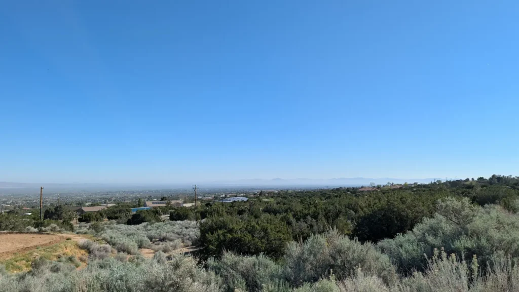
Elevation, Climate, and the Sovereign Position
Pinon Hills sits at 4,000 to 4,500 feet above sea level. That elevation differential produces a meaningfully different climate than the valley floor — cooler summers, cold winters, and snow accumulation possible from November through March.
For the buyer profile that targets Pinon Hills, this is not a liability. It is the point. The elevation creates natural separation from the valley floor, reduces urban encroachment pressure, and defines the sovereign lifestyle position that Pinon Hills occupies at the apex of the High Desert corridor.
The sovereignty progression runs from Oak Hills at the Cajon Pass summit through Phelan on the plateau to Pinon Hills at elevation. Each community represents a deeper position. Pinon Hills is the apex.
Access, Commute, and the Brightline West Factor
Primary access is via Highway 138, connecting directly to the I-15 interchange at Cajon Pass. From the interchange: San Bernardino is approximately 25 to 30 minutes. Ontario and the broader Inland Empire logistics corridor are approximately 45 to 60 minutes depending on origin point within 92372.
The Brightline West high-speed rail project — $21.5 billion total cost — has confirmed geotechnical borings at a Hesperia station on the I-15 corridor. For Pinon Hills buyers, the Hesperia I-15 station represents approximately 15 to 20 minutes via Highway 138 east. That connection to a high-speed rail network changes the commute calculus for buyers willing to trade drive time for elevation and sovereignty.
Source: Brightline West, January 2026.
Who Buys Land in Pinon Hills CA
The sovereign buyer: Pinon Hills is the deepest position in the High Desert corridor. PH/RL zoning, no city oversight, no HOA, and unincorporated county jurisdiction produce the most operationally free land configuration within commutable distance of the Inland Empire. Water certificate status, zoning designation, and buildable envelope — accounting for WJTCA and RC overlays — are the three data points that determine what you are actually buying.
The equestrian owner-operator: The 4,000-foot plateau combined with PH/RL by-right agricultural use makes Pinon Hills viable for regulation equestrian facilities. No HOA approval required. No city permit review for ag structures.
The multi-generational family: Primary residence, ADU up to 1,200 square feet under current California ADU law, guest structure, and agricultural infrastructure — all on a single fee simple parcel with no city or HOA involvement.
The commuter seeking depth: Highway 138 provides direct back-road I-15 access. Buyers who have evaluated Oak Hills and Phelan and want a deeper, more isolated position find it here.
The Net Rights Analysis Before Any Offer
Every parcel of land for sale in Pinon Hills CA should be evaluated against these four criteria before any offer is written:
- Zoning designation — PH/RL or otherwise. The by-right use profile changes completely depending on the designation. Do not assume from listing descriptions.
- Water certificate status — Active PPHCSD meter, Will Serve letter, or private well. Verify in-grid vs out-of-grid position. This is a material document on every transaction.
- Buildable envelope — FEMA flood zone status, slope analysis, RC corridor overlay, and western Joshua tree density under WJTCA. A parcel with overlapping overlays has a materially different development potential than the acreage alone suggests.
- Sovereign buildability test — Can the parcel support commercial vehicle storage, a workshop, and agricultural use without a CUP? On PH/RL parcels in 92372, frequently yes. Verify before any offer.
I run that analysis before you make an offer.
Frequently Asked Questions: Land for Sale in Pinon Hills CA
What county is Pinon Hills CA in? Pinon Hills is in unincorporated San Bernardino County. It is not a city and has no municipal government.
What is the zip code for Pinon Hills CA? 92372.
Can I keep horses on land in Pinon Hills CA? Yes — on PH/RL zoned parcels, horses and livestock are permitted by right without a Conditional Use Permit. Verify the zoning designation before any offer.
Who provides water in Pinon Hills CA? The Phelan Piñon Hills Community Services District (PPHCSD), covering 128 square miles across Phelan and Pinon Hills. Some outer western corridors are private well territory. Verify water service status before any offer.
Do Joshua trees affect what I can build in Pinon Hills? Yes. The Western Joshua Tree Conservation Act (Fish and Game Code Section 1927 et seq.) prohibits removal of live western Joshua trees without a CDFW permit. Parcels with significant Joshua tree coverage have a restricted buildable envelope. Assess tree density before any development plan.
What is the median land price in Pinon Hills CA in 2026? The median sold price for 92372 was $510,000 in February 2026 per RPR data. The active listing range runs from $299,800 to $799,900. Water certificate status and zoning designation are the primary value drivers within that range.
How far is Pinon Hills from the Inland Empire? The I-15 interchange at Cajon Pass via Highway 138 puts Ontario approximately 45 to 60 minutes from most of 92372 depending on origin point.
Jeremy Wilson | Wilson SoCal Homes | RE/MAX Freedom | DRE #01998524 (951) 336-1873 | wilsonsocalhomes.com